


|
|
The Hydrometeorological Automated Data System (HADS) is a real-time data acquisition and data distribution system operated by the National Weather Service Office of Observations. |
|
HADS web pages are structured to provide necessary system information and site meta-data to National Weather Service Offices.
|
Site Search |
| Enter NESDIS ID | Enter NWSLI ID |
|
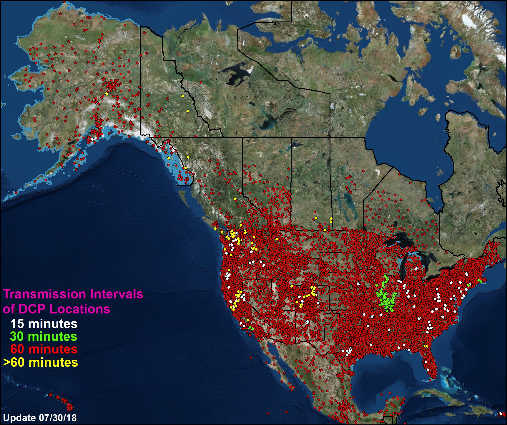
More than 18,000 data points on the image below represent the locations at which river and weather data are observed and subsequently processed by HADS.
|
|
|
|